Indian Creek Stream Corridor
Indian Creek Stream Corridor
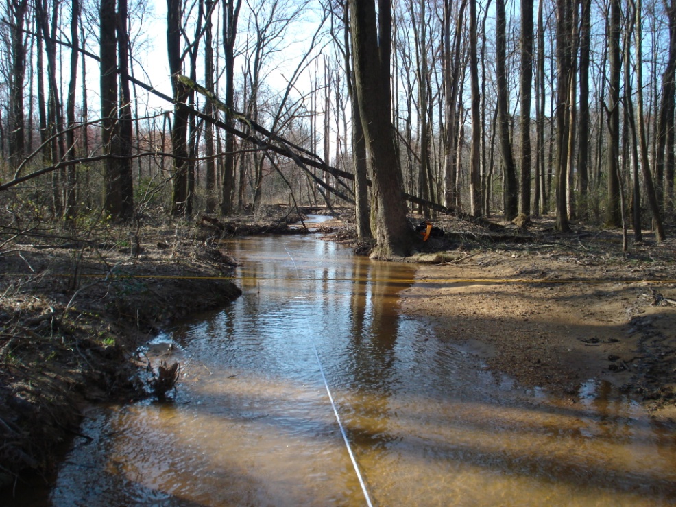

JMT provided stream improvement and restoration design plans for approximately 6,050 feet of the Indian Creek stream corridor as part of the environmental stewardship efforts undertaken as a result of the Intercounty Connector project.
The purpose of the study was to characterize the stream reach and determine the potential need for stream restoration, stabilization, floodplain re-connection, water quality improvements, riparian wetland creation, fish passage improvements, habitat enhancement, and other potential improvements. The drainage area to the Indian Creek project reaches was approximately 8 square miles with an impervious cover of approximately 24.3%.
Indian Creek had deteriorated greatly due to historic and more recent manipulations to the stream valley and channel, including stream channel straightening, construction of dams, on-line ponds, mining, lining, and armoring of open channels, dense urbanization, and impacts from roadway and railway embankments.
The scope of this project involved the development of an understanding of the existing impacts within the watershed, the current geomorphic processes and causes of instability to develop potential restoration recommendations. To complete these efforts, the design team performed data collection and assessment efforts in the watershed, including geologic and historic data collection, water quality analysis, natural resource inventories, hydrologic analysis, site investigations, stream bank sediment and soil study, and geomorphic surveys and analysis including Rosgen stream assessments, channel stability assessment, and sediment mobility study.
Based on assessment and analysis efforts, JMT’s design team provided three preliminary design options for each identified site. Preliminary contract drawings, construction cost estimates, design report, and a cost/benefit analysis were prepared so the client and permitting agencies would have the information required to select the best alternative for each reach. JMT presented preliminary design options to the client and permit agencies ranging from providing fish passage through concrete-lined reaches to the creation of a hydraulically-connected floodplain approximately 300 feet in width so all groundwater, base flow, and flood flows could be attached to a dense riparian wetland zone.