Franklin Hill Irishtown Bend Bank Stabilization
Franklin Hill Irishtown Bend Bank Stabilization


The Cleveland-Cuyahoga County Port Authority selected JMT for this ongoing project to prepare preliminary designs of measures to stabilize a critical portion of the Cuyahoga River left bank and valley wall, known as Irishtown Bend, that could potentially collapse into an important navigation channel upstream from downtown Cleveland.
Approximately half of the site is listed on the National Register of Historic Places, which impeded the ability to create access for exploration purposes and complicated remedial action planning. This was compounded by the presence of wetlands that developed over a significant part of the site. Perhaps most problematic was the lack of a coherent geological model for the site that would guide any needed geotechnical investigation and provide a basis for evaluating the feasibility of remedial options. Finally, ongoing slope failures along the riverbank and at the crest of the approximately 100-foot-high valley wall slopes gave the impression of an impending catastrophe.
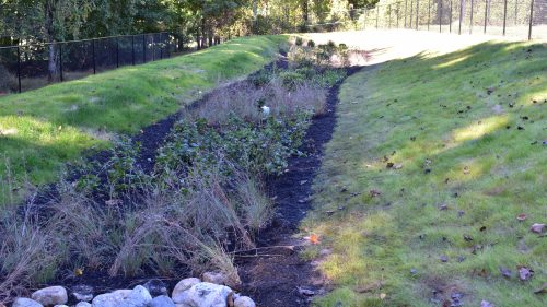
The main priority of this project was to stabilize the riverbank. JMT designed a bulkhead that incorporated the environmental enhancements that were a priority to the Authority, as the agency works to improve the ecology of the river.
JMT performed a balanced program of study and engineering that focused on understanding the factors causing the site’s instability. Our research revealed previous investigations going back 60 years, totaling more than 40 borings, collection of more than 1000 soil samples, and installation of multiple piezometers and inclinometers. With this discovery, the need for additional exploration became less urgent in favor of analyzing existing data.
JMT conducted statistical evaluations of the data to determine trends in soil strength and stratigraphy. The most glaring deficiency in the existing data set was the lack of soil strength data, particularly at depths where failure planes may be present. Cone penetrometer testing was conducted at several locations around the site to obtain continuous data profiles from which strength properties could be inferred. Raw data from the acquisition system were analyzed using an in-house developed software solution for estimating shear strength, angle of internal friction, and precise stratigraphic correlations.
On a parallel track, the history of Irishtown Bend was assessed both on a geological timescale and a shorter, more current one. This revealed the possible presence of deep-seated paleo-failure planes associated with post-glacial conditions, but also suggested that most of the problems observed had origins significantly less than 100 years old and appeared to be separate, distinct issues that could be remediated individually. Primary among these was the ongoing erosive effect of bow and stern thrusters on the tugboats and freighters that continuously bombarded the shoreline with high energy water jets, resulting in a degraded and unstable riverbank. Other factors included historical grading (circa 1960s) where fill was unwisely placed along the crest of the valley wall to create developable land. Modification to the groundwater regime also took its toll.